
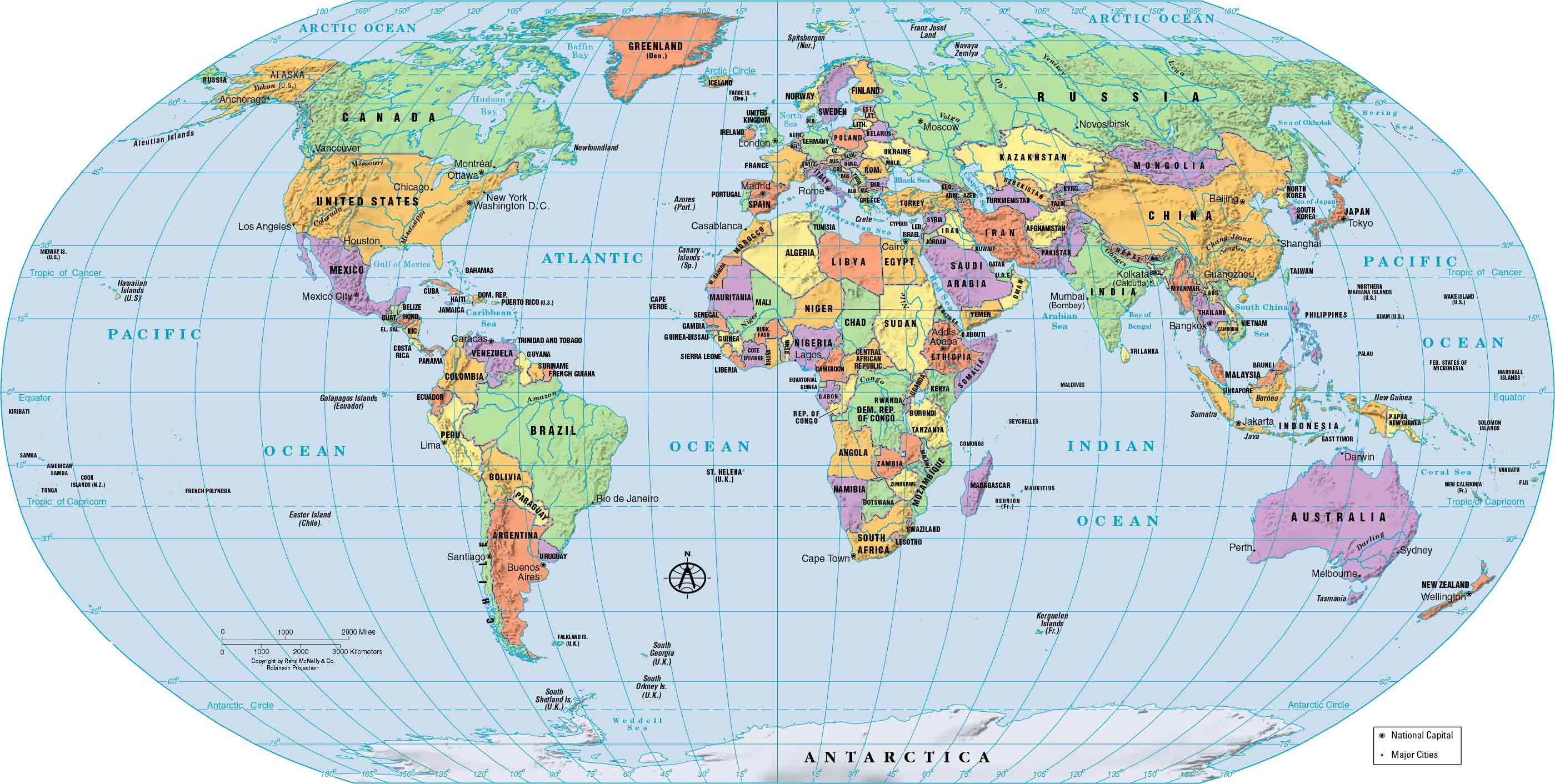
Atlas is a term that can refer to a book of maps or a collection of geographical information. An atlas typically includes maps of various regions and countries, as well as other geographical information such as facts about population, climate, and natural resources. The term "atlas" comes from the Greek mythological figure Atlas, who is said to have supported the world on his shoulders.
Gerardus Mercator was a German-Flemish geographer and cartographer who is best known for his work on maps and projections. His 1595 book Atlas Sive Cosmographicae Meditationes de Fabrica Mundi et Fabricati Figura was the first to use the term "atlas" in the title, and it included a collection of maps and other geographical information. Mercator's work was influential in the development of modern cartography and the use of the term "atlas" to refer to a book of maps.
The original edition of Gerardus Mercator's Atlas Sive Cosmographicae Meditationes de Fabrica Mundi et Fabricati Figura was a wide-ranging text that included not just maps, but also other geographical information and discussions of cosmology and the creation of the universe. However, as the book went through subsequent editions, it became primarily a collection of maps, and it was in this form that the term "atlas" came to be used more generally to refer to any collection of maps.
History
The history of atlases dates back to ancient times when people first began creating maps and other visual representations of the world around them. The ancient Greeks and Romans, for example, produced maps and geographical treatises that were used for both practical and theoretical purposes. In the Middle Ages, maps were often included in books of travel and exploration, as well as in religious texts.
It was not until the 16th century, however, with the publication of Gerardus Mercator's Atlas Sive Cosmographicae Meditationes de Fabrica Mundi et Fabricati Figura, that the term "atlas" came into widespread use to refer to a book of maps. Since then, atlases have continued to evolve and be updated with new information, and today they are available in both print and digital formats.
The first modern atlas, Theatrum Orbis Terrarum by Abraham Ortelius, was published in 1570. This was a collection of maps that were systematically arranged and presented in a uniform format, and it is considered to be the first true atlas. Prior to this, maps were often included in other types of books, such as travel guides and religious texts, but they were not typically organized into a single volume.
Atlases published in the 16th-19th centuries were often not bound and ready for purchase, but rather were sold as individual components that the customer could select and have bound according to their preferences. This made early atlases highly customizable but also meant that different copies of the same atlas could vary in their contents.
In the 19th century, national governments began producing their own atlases as a way of promoting their countries and providing geographical information to the public. These atlases were often large and comprehensive and included detailed maps of the country and its regions, as well as other geographical information. Today, atlases are still widely used, although they are now available in both print and digital formats.
Types
There are many different types of atlases, and they can be organized based on a variety of criteria. Some common types of atlases include:
- General atlases are comprehensive collections of maps and other geographical information that cover the entire world or a large region.
- Thematic atlases focus on a specific topic or theme, such as climate, population, or natural resources.
- National atlases are produced by governments and provide detailed information about a specific country or region.
- Historical atlases include maps and other information from a specific time period in history.
- Digital atlases are online collections of maps and other geographical information that can be accessed through a computer or mobile device.
Atlases can also be organized based on the scale of the maps they contain, with some atlases featuring small-scale maps that cover large areas, and others featuring large-scale maps that provide detailed information about smaller areas. Some atlases may also be organized based on the format in which they are presented, such as books, websites, or interactive digital maps.
A travel atlas is a type of atlas that is designed for use during travel, and typically includes maps at a large scale that can be easily reviewed and navigated. Travel atlases often have spiral bindings so that they can be folded flat, and may also include other useful information for travelers, such as points of interest and road conditions.
A desk atlas, on the other hand, is a type of atlas that is designed to be used as a reference book. It is typically larger and more comprehensive than a travel atlas, and is often published in hardback or paperback form. Desk atlases may include maps of the entire world or a large region, as well as other geographical information and illustrations.
In addition to atlases of the earth, there are also atlases of the other planets and their satellites in the solar system. These atlases provide detailed information about the geography, geology, and other features of these celestial bodies. There are also atlases of anatomy, which map out the organs and other structures of the human body or other organisms. These atlases are often used by medical professionals and students to study the anatomy of the body.
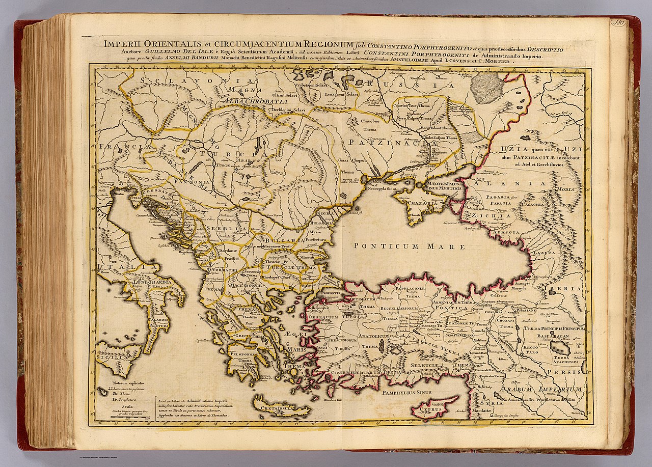
Imperii Orientalis et Circumjacentium Regionum (The Empire of the East and the Adjacent Regions) is a book of maps published in 1742 by the French cartographer Guillaume Delisle. The book includes a collection of detailed maps of the eastern part of the world, including Asia, the Middle East, and the Indian Ocean. Delisle's work was known for its precision and accuracy, and his maps were considered to be some of the most detailed and reliable of their time. The book was published in several editions, with some editions including additional maps and other geographical information.

Theatrum Orbis Terrarum (The Theatre of the Orb of the World) is a world map created by the Flemish cartographer Abraham Ortelius in 1570. This map is considered to be the first modern atlas, as it was the first to systematically arrange and present maps in a uniform format. Ortelius's map is a large, double-page map that depicts the entire world as it was known at the time. It includes detailed information about the geography, political divisions, and other features of the world, and is considered to be one of the most important and influential maps of the early modern period. Theatrum Orbis Terrarum was published in several editions and was widely used and copied by other cartographers in the following centuries.
.jpg/1024px-Nova_et_Accuratissima_Terrarum_Orbis_Tabula_(J.Blaeu%2C_1664).jpg)
Joan Blaeu was a Dutch cartographer and publisher who is best known for his work on the Atlas Maior, a large and comprehensive atlas of the world that was published in the mid-17th century. Blaeu's world map was originally prepared for inclusion in the Atlas Maior, and was later published in the first book of the Atlas van Loon, a collection of maps and other geographical information that was compiled by Gerard van Loon. The map is a large, detailed depiction of the world that includes information about the geography, political divisions, and other features of the world as it was known at the time. It is considered to be an important and influential work of cartography from the early modern period.